


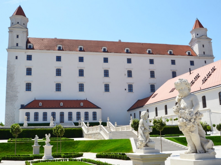
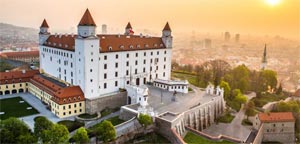
Bratislava Castle
Bratislava Castle is the dominant of the Capital of the Slovak Republic - Bratislava. It stands on a hill on the left bank of the river Danube, where dominates building of the former royal palace. The castle is an important memorial of historical development in the history of Great Moravia, ...


Museum of SNP - Memorial to Tokajík tragedy
Exposure of Museum of the Slovak National Uprising called Fascist reprisals in eastern Slovakia is situated in the village Tokajík in northeastern Slovakia. Opposite the museum there is a memorial dedicated to the victims of fascist reprisals in village Tokajík, who were murdered at the burning down of the village on November 20, 1944. Source: www.muzeumsnp.sk


")


")


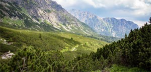
Blue lake
Blue Lake (in Slovak Modré pleso) is the highest located mountain lake in High Tatras in Slovakia - in Region Prešov (Prešovský kraj), district Poprad. It is located under the Small Ice Peak (Malý ľadový štít) at the end of Small Cold Valley (Malá studená dolina) at altitude of 2 192 m a.s.l. ...
Vihorlat Mountains
Vihorlat Mountains (Vihorlatské vrchy) is mountain range in East Slovakia and partly in the west of Ukraine. It is located in Prešov Region (Prešovský kraj) - districts Humenné and Snina and in Košice Region (Košický kraj) - districts Michalovce and Sobrance on the territory of Slovakia. Highest peak of Vihorlat Mountains is Vihorlat (1 075,5 m. a.s.l.). There is Vihorlat Protected Landscape Area, and Vihorlat primaeval forest which has been declared a site of UNESCO World Natural Heritage in year 2007 on Vihorlat Mountains territory.